

While Summer might be perceived by many as a quieter time around the department, it has been far from that in the Civic Data Design Lab. We've seen the very exciting launch of transit data in Nairobi on Google Maps with Digital Matatus, the development of a new app to visualize social media and pollution conditions in China, and a writeup on the innovative technologies of the City Digits project collaboration. In addition to these ongoing research projects, a number of new and exciting initiatives have launched this Summer.
One new project this Summer has been the investigation of how we can leverage drone technology in the collection of project data. The goal is the creation of detailed 3D site plans, digital terrain models, and timely high resolution orthophotos. Through the use of remote sensing techniques and photogrammetry, an incredible amount of data can be captured and processed. To train in the technology, the lab partipated in a flight training session to learn how to fly, explore the capabilities of the equipment, and collect test data.
Drone Flight Training Day
On a muggy Wednesday afternoon in August, DUSP GIS Specialist and CDDL lab member Mike Foster joined a team of researchers on a training session provided by two artists capturing aerial footage for an independent project. The primary goal for the day was to train in drone operations, but in the process, we took the opportunity to collect some aerial imagery and test data.
The training and flight tests were exciting. The following short video showcases our day.
The Sheephold, Middlesex Fells Reservation
The training test site is a small field called the Sheephold in the Middlesex Fells Reservation, a large natural area about 15 minutes north of Boston. You see in the video, the Interstate 93 freeway splits the park in two. The location works well because it provides a large area for flight without having to travel too far from the MIT campus. The Sheephold field itself is about 10 acres in size and clear of trees and obstacles, allowing for safe operation.
During the training, we captured a large number of photos and videos from the ground and from the drone. Most importantly, we were able to learn some best practices on drone flight and data collection. A few details on our flight:
Equipment:
- DJI Inspire 1 with two-remote control system
- Nexus Tablet for flight control
- Gimbal for GPS-enabled video and photography
Flight details:
- 3 swaths of footage of test site (Sheephold)
- Video collection for extracting stills with atleast 60% overlap
- Camera at Nadir (pointing straight down)
- Flight height of about 200 feet
- Ground control was collected in four locations in the flight coverage area
Our time in the field was productive. Documentation of our training session follow.

The Sheephold. Our test project site.

Marching off to find a safe launch site.

The DJI Inspire. Inspecting our equipment and getting set for flight.
Ready to go. We have lift off!!
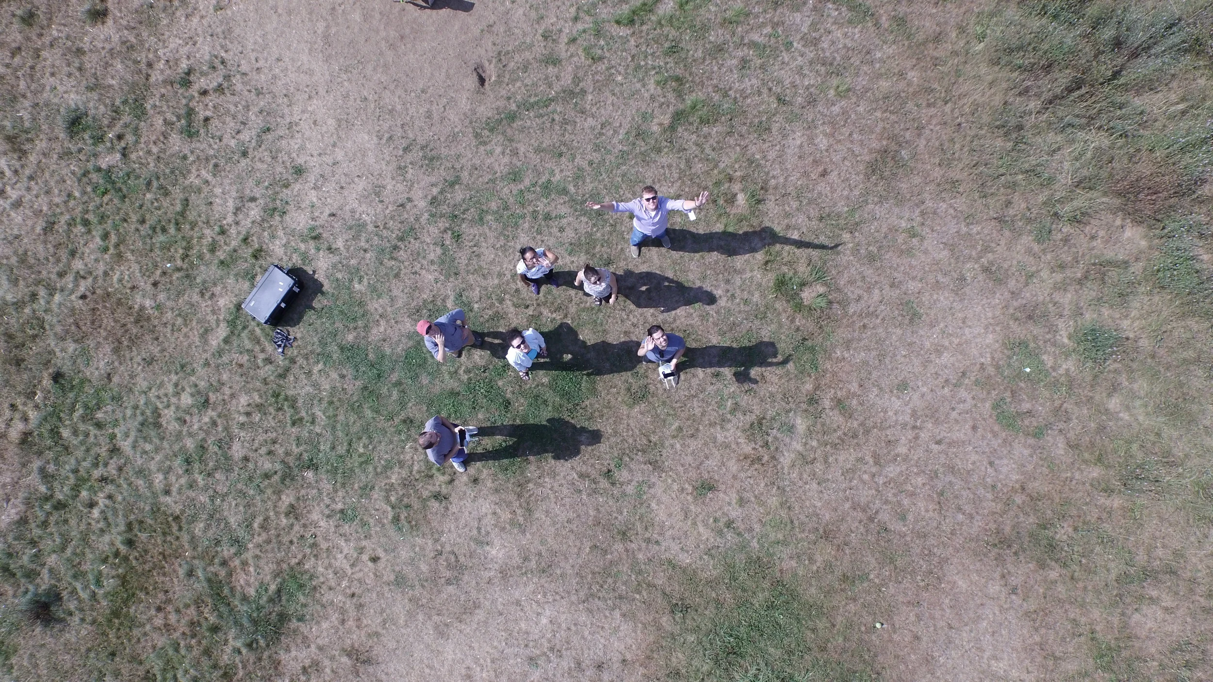
#droneselfie

Approximate flight path for data collection.

The DJI Inspire drone.

Matthew and John, our fearless training instructors.
With the video, we could extract individual frames to build our aerial dataset. Following training, we began processing of the imagery and evaluation of the applications in urban planning and architecture.
Look for some exciting developments on how the Civic Data Design Lab and DUSP are using drone technology this upcoming year!