
By Emily Eros
The Civic Data Design Lab is proud to announce that we’ve just officially released our first version of Nairobi’s transportation map! CDDL has been working on data collection, mapping, and conversion to a standard digital format (GTFS) over the last year or so as part of a collaboration between the University of Nairobi, MIT, the Center for Sustainable Urban Development at Columbia University, and Groupshot. In particular, Wenfei Xu put in an overwhelming amount of time and effort into designing a map that’s both functional and very attractive.
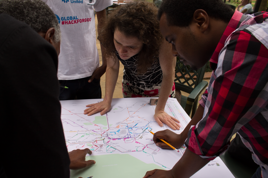
The team tackles some final map revisions
A couple of weeks ago, members of the team traveled to Nairobi to release the map, launch the data, and meet with relevant members of the press, government, and local/international institutions. Because we want this project to be self-sustaining and successful within the city, the team has been careful to pursue dialogue with local organizations and individuals (like UNHABITAT, KARA, KIPRA, and the city government) who may be interested in the project and might wish to get more involved. The map/data launch took place on 28 January. Over 60 people were excited enough about transportation to attend the event, and the media was present in full-force. The project has been featured on both local news outlets (The Star and The Nation) as well as the Atlantic Cities.

We're in the news!
We also hosted a transit hackathon at the University of Nairobi. Over the weekend of 25-26 January, eight teams of up to four university students each participated in the collaborative programming competition, forgoing other weekend activities in order to play with our data. The teams came up with a number of interesting ideas, from route planning apps to apps designed to integrate with the local Beba Pay system, and a variety of others. One app functioned as a means for group ridesharing, effectively enabling partygoers to “crowdsource” a matatu ride home late at night. First place was awarded to an entry called Ktransit. Ktransit functions as an API that parses through the GTFS feed in order to give meaningful responses to queries about stops, routes, and other information contained in the data feed. As such, the tool effectively “translates” a series of comma-delimited data into meaningful information.

UoN students hacking away
It was inspiring to watch so many students get excited about their city’s transportation system, and to see how creative they could be over the course of just a weekend. We’re excited to watch this project move forward and to see what sort of innovation will come next!